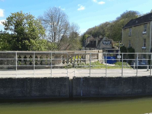
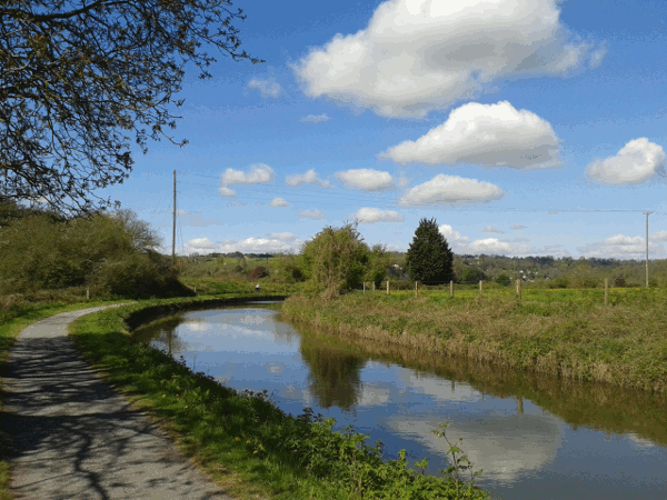
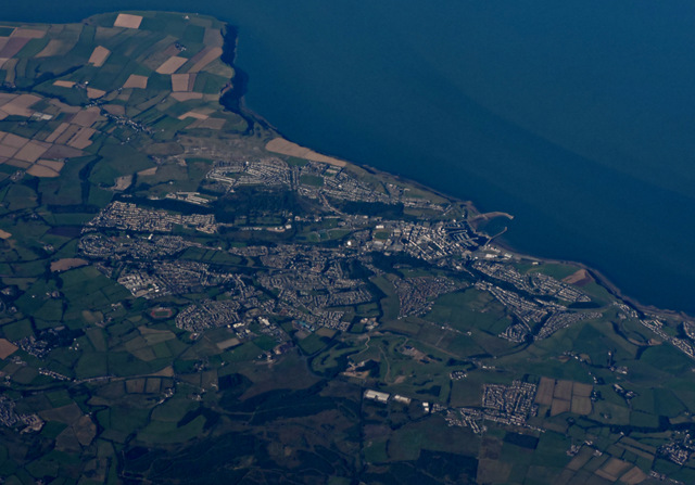
Tag name:walking

Whitehaven

First published 8th August 2015 (Last Modified 5th April 2023)

Aerial picture of Whitehaven

I recently visited Whitehaven to meet up with Sue & Matthew as they sail their boat up to Scotland. As is usual for their travels, this wasn't the original plan (which was to meet up in Liverpool). I travelled by train, with my original plan being scuppered from the start as the train from Romsey to Southampton was delayed by just enough to allow me to miss the Southampton to Birmingham International train. Fortunately this only caused a hour or so's delay to my journey (which got distinctly less busy the further North I went).

I stayed for three nights to allow us two days of sightseeing. Tuesday was spent travelling on the Ravenglass and Eskdale narrow gauge railway and exploring around Dalegarth, which included mistaking a river edge for the path we were aiming for - my excuse is that we weren't the first to make that mistake as evidenced by the boot tracks!

Wednesday we explored around Whitehaven including the Rum Story, which was surprising large and a good museum (lots of information boards and explanations of the exhibits, my personal preferred information source since it allows me to go at my own pace and speed). We also visited Haig pit, an old coal mine (the last one to be closed locally). This was also very interesting, though has only the surface building open.

My return trip was uneventful, which shows it is possible to travel the length of England without trouble (even if the odds are lower than 100%!)

Bath to Bristol

One of my minor goals has been to successfully walk all the way from Bath Spa to Bristol Temple Meads. My previous attempts have usually involved the Bristol to Bath cycle route (which follows the old Midland Railway from Bath Green Park via Bitton). This route, while flat like most routes that use old railway lines, is a bit long. The SUSTRANS web site claims it's 13 miles, but I think a more reasonable estimate is 14-15 miles based on my experience - though to be fair I've always been forced to break it in the middle at Bitton and detour to Keynsham station (which is a significant-ish detour).

Today, though, I decided to walk along the River Avon to Keysham using initially the towpath (which I would note would actually now be hard to use for towing barges since there are plenty of trees along the actual river's edge once you're outside of Bath). This does meet up with the cycle route, which I used only to cross the river from the North Bank to the South Bank and then followed footpaths along the South Bank (and hence largely following GWR's railway from Bath Spa).

Once at Keynsham though, I checked my phone's map (I use the maps.me app which is based on the data from openstreetmap) and discovered that from there it was less than five miles to Bristol Temple Meads as the crow flies. The computed pedestrian route was six miles (which, as I'm not a crow or a car, is the route I wanted to follow).

It turned out to be pretty straight forward and followed footpaths in the main rather than roads. Usefully Bristol City have recently given most of their paths a hair cut recently, so the paths were only muddy and not completely overgrown!

I didn't stop for food - big meal was planned (and eaten) for the evening - total journey time about four hours and twenty minutes - which probably equates to about 14-15 miles (so I could have just followed the cycle path!).

Bath Castle

First published 25th March 2017 (Last Modified 24th January 2021)

Today I did a walk from Bath to Bradford on Avon via Bath Castle. I had originally planned to do a circular walk from the book On Foot in Bath by Andrew Swift, but changed course halfway through. The first part of the route, following the book takes you up to the hills east of the city and you arrive at:

Front view of sham castle

This is a nice view of the front - but you should be a bit suspicious as this more side view reveals:

Side view of Sham Castle

This is actually Sham Castle, built in the late 1700s and apparently by the builder of Prior Park 1, even if it's not actually visible from Prior Park! (It is visible from Bath itself if you know where to look (the city is, of course, much more built up than it would have been when Sham Castle was built)).

After visiting the castle, I continued on the walk as described in the book until reaching Combe Down. There, since it was close to Monkton Combe, I decided to divert off of the described route and headed off in the direction of Dundas Aqueduct and the Kennet and Avon Canal.

I was glad I did, since I managed to get to the Aqueduct via a new route which wends its way to the canal from the hills and allowing me the following view of the Aqueduct:
A view of Dundas Aqueduct looking east from above

Footnotes

  1. which is somewhere else around Bath that I'd definitely recommend visiting, though it wasn't on my route today

Favourite Walk

First published 3rd May 2015 (Last Modified 9th January 2021)
In my spare time I do a lot of walks. That's not long distance walks, but more straight-forward, but still multi-hour length walks. Ignoring the walk into Romsey, the most common walk I do is to/from Bradford-on-Avon to/from Bath and last time I did this I took some
photos to enable me to attempt this blog post.

bradfordOn this occasion, I did the Bradford-on-Avon to Bath direction, so starting. obviously, at Bradford-on-Avon. Since I use the train to get to Bradford, the walk starts there!

There's a direct train service from Romsey (FGW's Portsmouth to Cardiff service) and Bradford-on-Avon station was built by GWR (as evidenced by the supports for the benches on the platform - you can see the wooden templates for these at the STEAM museum in Swindon).

On leaving the station (over the footbridge) I head though the municipal car park to the river avon and under the railway bridge (signposted "Tithe Barn" - which I really ought to visit some day!)

I now head south through a park (the edge of the Barton Country Park) and up some steps to the Kennet and Avon Canal.

kacanalThe Canal predates the railway, but was bought out by the GWR and allowed, over the course of a century, to fall into disrepair. Fortunately for me the canal was restored during the 1960s, 1970s and 1980s and the towpath forms part of the National cycle network route 24 (which goes from Bath to Eastleigh).

Being a canal (and this section is without any locks) this part of the walk is nice and flat. On reaching the tow path, I turn right and head west along the towpath.

There's usually plenty to see including canal boats (both moored and chugging along) and ducks and sometimes other wading birds (I've seen herons, swans and other similar birds). Along this stretch of the canal, there's also plenty of other walkers and cyclists to watch out for.

avoncliffAfter about a mile or so the canal reaches the village of Avoncliff and its aqueduct (Note the photograph isn't one of my best - I need to try to take a better one, probably from the railway station). The towpath cross under the aqueduct at this point, if you don't change sides you'll end up at Avoncliff's railway station (trains about once a hour stop here, my train from Romsey does not stop at either Avoncliff or Freshford, the next station down the line about two and a bit miles further down the railway line).

The Cross Guns pub is a nice place to break the walk, though as it's close to the start of the walk, I normally just continue onwards. The beer garden is down the slope to the left (in the photograph) and has an excellent view of both the aqueduct and the river Avon.

The aqueduct crosses both the river Avon and the railway line and the route now turns west to follow the contour line along the northern edge of the river valley.

kacanal2This next stretch of the walk is quieter (there are both fewer walkers and fewer cyclists, though I do continue to keep an ear for cyclists sneaking up behind me. The railway initially stays relatively close to the canal until the contour line for the canal gently curves off to the north.

There are some excellent views across the river valley, though you do have to peer through the trees to catch a glimpse.
expensivehouse

There are a few houses along this stretch of the canal - I would guess these would be quite expensive if they came on the market!

dundasAfter about four miles or so the canal needs to recross the valley to find a decent contour to follow. It does this via the magnificent Dundas Aqueduct (though this also needs a better photograph!). The aqueduct and the adjoining basin (which also connects to the Somerset Coal Canal).

This aqueduct, like that at Avoncliff, also recrosses the railway line, but note there's no station here. I have walked from here to Freshford railway station that's about two miles to the south. Unfortunately to reach it does require a walk along a stretch of the B3108 which doesn't have a pavement, so some traffic dodging is required.

Here there's a decision to be made on the route to Bath. You can continue to follow the towpath (note that just past the aqueduct it crosses the Kennet and Avon Canal again). This takes you into Bath via Bathampton and the glorious Syndey Gardens and though a couple of short tunnels to the flight of locks that joins the canal to the River Avon close to Bath Spa station.

coalcanalThis time, however, it's the route via the Coal Canal that I'll take. This short section of restored canal is used as a mooring for lots of narrow boats and leads to the Angelfish Cafe which is a good point to break when I haven't brought sandwiches. (There's also boatyard here).

From here we head along footpaths that allow me to skip part of the National Cycle Route 244, but end up quickly rejoining that as it heads through the grounds of the Monkton Combe Private School to the village itself. From here I head through the church yard to again rejoin the cycle route until it reaches Tucking Mill. As a walker I can use the short cut that leads past Tucking Mill reservoir. The reservoir is used (according to the various notices) for angling for disabled anglers though it has always been quiet when I've visited.

tuckingmillI now head up the slope to the top of the viaduct to rejoin the National Cycle Route 244 again. The viaduct forms part of the old Somerset and Dorset line that led from Bath (Green Park) to Templecombe via Evercreech Junction. For most of the rest of the walk, I (and the National Cycle Route) will follow this old converted railway line into Bath.

If I've brought sandwiches I'll break for lunch at the top of the viaduct - As I'm back on the cycle route there's some passing cycle traffic, but I'm still far enough out from Bath, that it's relatively quite.

This section of the S&D opened in the 1870s and was closed as part of the Beeching Cuts in 1966. The route reopened as a shared use (walking and cycling) path in 2013 (just in time for me to start using!)

combedownI now head north along the path (as the route up the slope to the viaduct is on the south side of the viaduct, this means I get to cross the viaduct, though fencing along the edges of the viaduct stop you from getting to the edge. Very shortly after the viaduct the path reaches the Combe Down tunnel.

This tunnel is about a mile long with bends near beginning and end. It takes me about 15-20 minutes to transverse. There is (dim) lighting throughout the tunnel, but it's definitely a strange experience. One of the oddities is realising that there's a suburb of Bath (Combe Down) above your head, yet it was countryside when you entered the tunnel (on leaving the tunnel it is a little more obvious as there's a junior school near the route here).

After Combe Down tunnel there a short stretch out in the open before we dive underground again via the Devonshire tunnel. This tunnel is much shorter (just over quarter of a mile) but twister so you still can't see from one end to the other.

I've yet to take a decent picture inside the tunnel (I need to avoid temptation and not attempt to include the end of the tunnel!).

Once though the two tunnels, the route continues along the old railway route as part of the "Linear Park" (Linear in this case used to imply thin as it's definitely not straight) leading you to Oldfield Park.

I normally leave the path here to head more directly into Bath (on this occasion I attempted to find the River Avon to head alongside the river back into Bath. However I failed to accurately reverse the route I have taken in the past and missed the riverside path (the bridge I used had no good connection to that path) so I ended up following relatively busy roads back into Bath.

As usual for the Bradford to Bath walks, I ended up missing the train back to Romsey by ten minutes (though in this particular case it wouldn't have mattered as that train ended up being cancelled anyway).

Reaching Devizes

Earlier this week I took advantage of having the Portsmouth Harbour <-> Cardiff Central diverted to Swindon to travel direct to Melksham (on the single track line that joins Trowbridge to the Great Western Main Line. I did this so that could easily complete another section of the Kennet and Avon Canal, this time the section between Semington (just south of Melksham) to Devizes.

caenflight
This section includes the Caen flight of locks, making for me an interesting walk and, I'm sure, for canal boaters, a fearsome challenge. Before you get to the actually the flight, and unlike the canal stretch from just above Bath to Bradford-on-Avon, you've already encountered a good half a dozen or more locks and then you meet this monster - a set of 16 locks achieving a gradient 1 in 30 or better (which is better than any incline on the main line railway).

Once I'd reached Devizes itself, it was a matter of a bus ride back to Salisbury for the journey home.

For the record, I've now walked (in sections) all the way from Bristol to Devizes:

  1. Bristol (Temple Meads) to Keynsham (14 April 2014)
  2. Keynsham to Bath (15 April 2014)
  3. Bath to Bradford-on-Avon (24 April 2014)
  4. Bradford-on-Avon to Trowbridge (11 June 2015)
  5. Trowbridge to Melksham (12 June 2014)
  6. Melksham to Devizes (26 August 2015)

(I did combine the Bath to Trowbridge sections into one on 17 August 2015, and the Keynsham to Bath section was along the cycle path on the old railway line rather than on the riverside path).

I intend to extend this to cover Avonmouth to Bristol and redo the Keynsham to Bath along the riverside at some point. Going beyond Devizes is harder - there's quite a big section to cover Devizes to Bedywn and Bedwyn is outside the "Freedom of Severn and Solent" rail rover ticket area and hence makes this trip quite a bit more expensive - still definitely a challenge worth aiming for.

Barcelona?

First published 2nd September 2016 (Last Modified 9th January 2021)

I've been enjoying my books giving city walks, and while the author sometimes concentrates too much on the architecture (and not quite enough on history in my opinion), it has lead me to this gem:

20160826_123725_stitch(As this image is a stitch together of a bunch of pictures I took (and have then scaled down in GIMP), I'm quite impressed with how the image has come out - the weird concrete curtains in the middle of the balcony wall is NOT an artefact of the stitching process!)

The building definitely reminds me of some of Gaudi's buildings in Barcelona - but this isn't Barcelona, it's actually Bristol!

(The same walk also led me past this pair of building, which could be from Amsterdam) 20160826_132024

Over 6 miles a day

First published 30th October 2016 (Last Modified 9th January 2021)

I keep a track of what my pedometer says I've walked (actually I first multiply its claim by 5/6 - Walking 80 chains in the Combe Down tunnel gives a distance of 1.2 miles according to the pedometer, but 80 chains is only one mile...). I then keep a 100 day running total so that I can see how well I'm doing against the 10,000 step target (which, for me seems to be about 4.4 adjusted miles). Over the last few weeks that total has been hovering at around 590 miles, but on Friday the total reached 600.2 miles!

Today, though, it will drop significantly back below that level (101 days ago was a 16 mile walk, and today is a quiet day at home) and given my seasonal trends it's likely to be on a steadily falling total until the spring. Since breaking 600 miles in a hundred days is a significant psychological milestone.

Emsworth to Langstone and back

First published 10th March 2017 (Last Modified 9th January 2021)

View from Langstone Harbour

Yesterday myself, Sue, Matthew and Brian arranged to take a walk from Emsworth to Langstone Harbour attempting to do a figure of eight so that we got two stretches along the shore line while still stopping for coffee and lunch along the way. The day started overcast but, as can be seen from the picture above, the weather steadily improved.

As can be seen from the outline of the route we took below, some sections were repeated. Partially that's my fault (in my youth I used live close to the western end of this map and hence just repeated the walking route I was used to) and partially because there wasn't a particularly interesting alternative!

According to my pedometer, my step count for yesterday was 23389 steps for a (corrected) distance of 10⅓ miles.

Outline of the route taken(Map created using uMap, so the map is © OpenStreetMap contributors 2017)

Blaise Castle

First published 28th March 2017 (Last Modified 9th January 2021)

Yesterday I upgraded my castle visit by taking a day trip out to Blaise Castle. This kind of trip is very possible to do when there's no trouble on the trains (I need to change at Bristol Temple Meads onto the Severn Beach line, so if there's a long delay on the line between Romsey and Bristol, I end up having to change plans).

Blaise CastleBlaise Castle is another folly - in this case a three sided castle like folly on a hill that overlooks both Bristol and with views, allegedly, out to South Wales (with the haze around Bristol yesterday there was no chance of that). The grounds of the Blaise Estate are managed by Bristol City Centre and, while overrun with dog walkers, is very much worth the trip.

Walking to Wales

First published 3rd September 2017 (Last Modified 9th January 2021)

Yesterday I did a walk from Severn Beach to Chepstow via the old Severn Bridge (the newer one (M4) doesn't have a walkway/cycleway on it). This is a walk that is only recommended on days without much wind as you're quite exposed once on the Severn bridge crossing. Also worth noting that you're actually not in Wales until halfway across the Wye Bridge (which crosses the River Wye).

View (looking North) from the eastern end of the Severn Bridge. Most of the view is actually England, although the hills in the distance next to the bridge in the West (left of the image) are Welsh.