A map of Salvoyn
A Map of Salvoyn
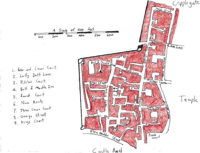
This map was based on Aldgate Ward in London. As such it needs reflecting horizontally across the middle of the map1. Compare with the map of Linrodeth as whole.
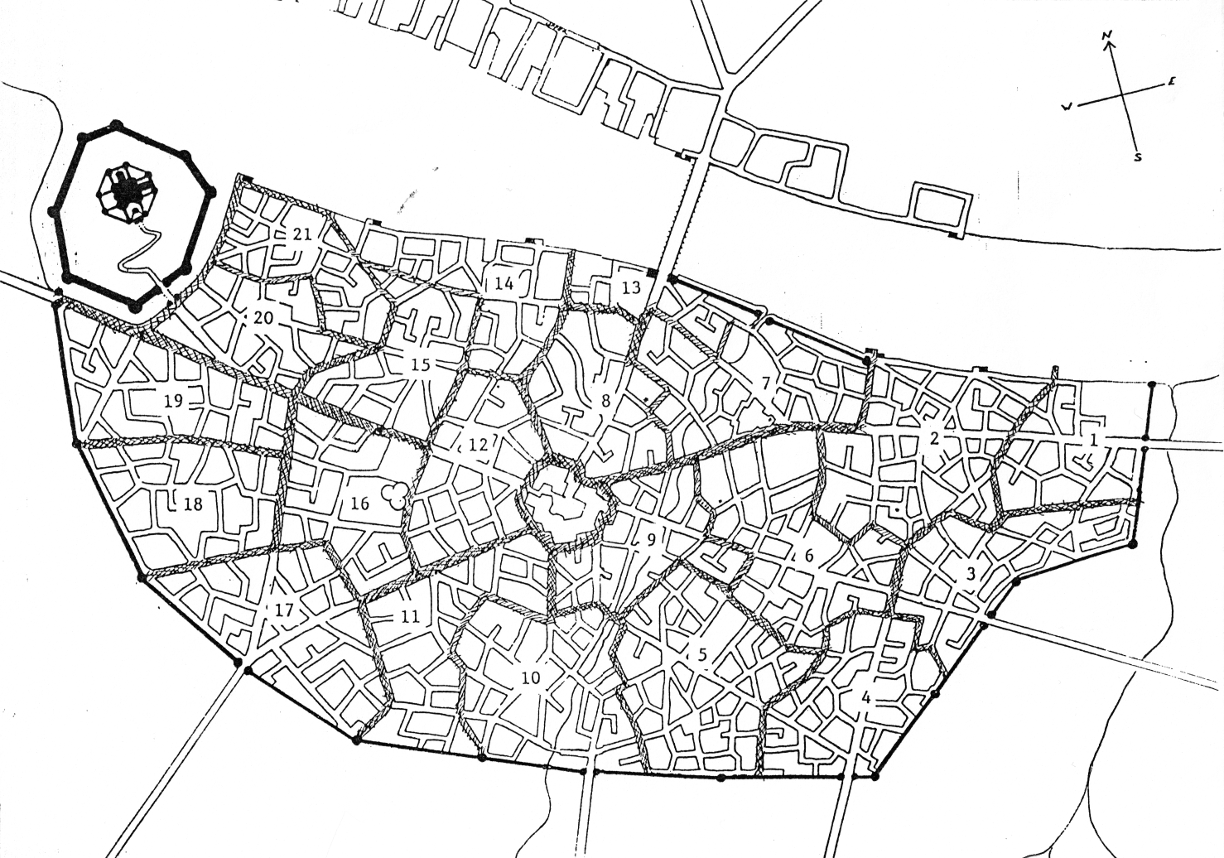
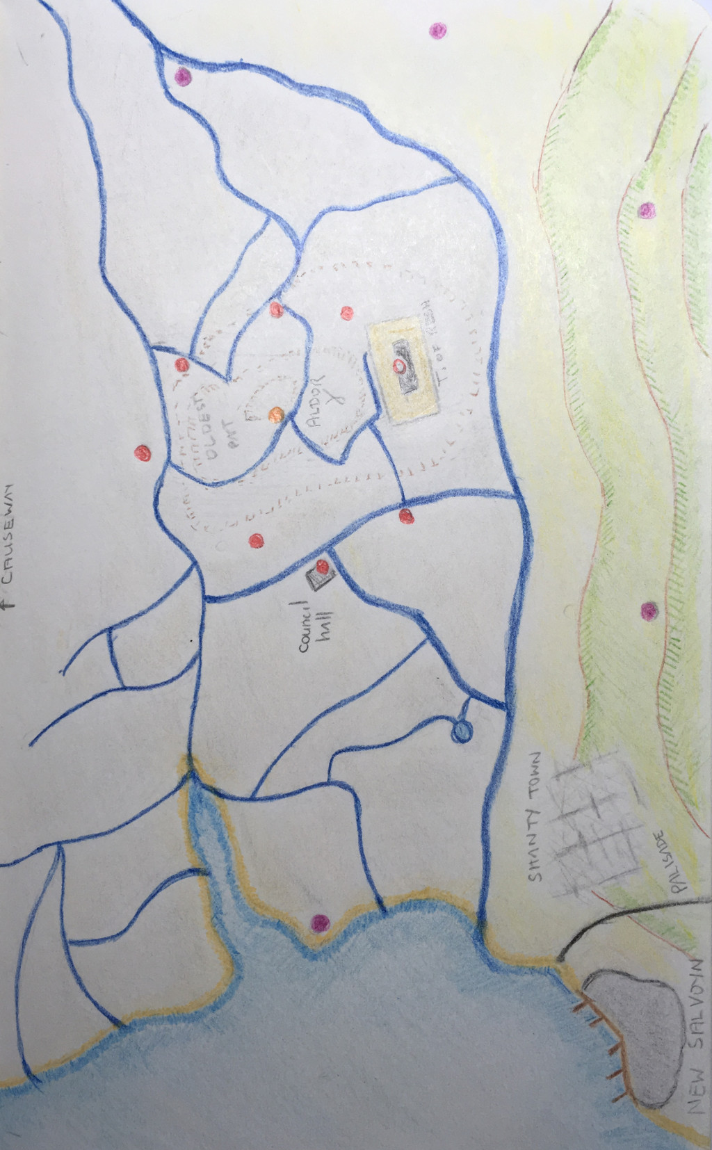
On the far side of the river, west of the bridge, lies the port and docks, while the area to the east of the bridge on the far side lies the slums and tosh heaps.
In the very centre of the City surrounding the Mootstone lies the Witanmoot, the seat of the City’s governance.
Adjacent to the wards of Dracas and Ishtan and dominating the river is the Citadel, the residence of his majesty the King of Athion.
|
1. Castle Bard |
12. Levestone |
|
2. Temple |
13. Bridge |
|
3. Oldgate |
14. Portsoken |
|
4. Avigon |
15. Shambles |
|
5. Cripplegate |
16. Welland |
|
6. Faringdon |
17. Kingsgate |
|
7. Dowgate |
18. Cadene |
|
8. Berewic |
19. Cartage |
|
9. Arpent |
20. Dracas |
|
10. Marshgate |
21. Ishtan |
|
11. Bassishaw |
|
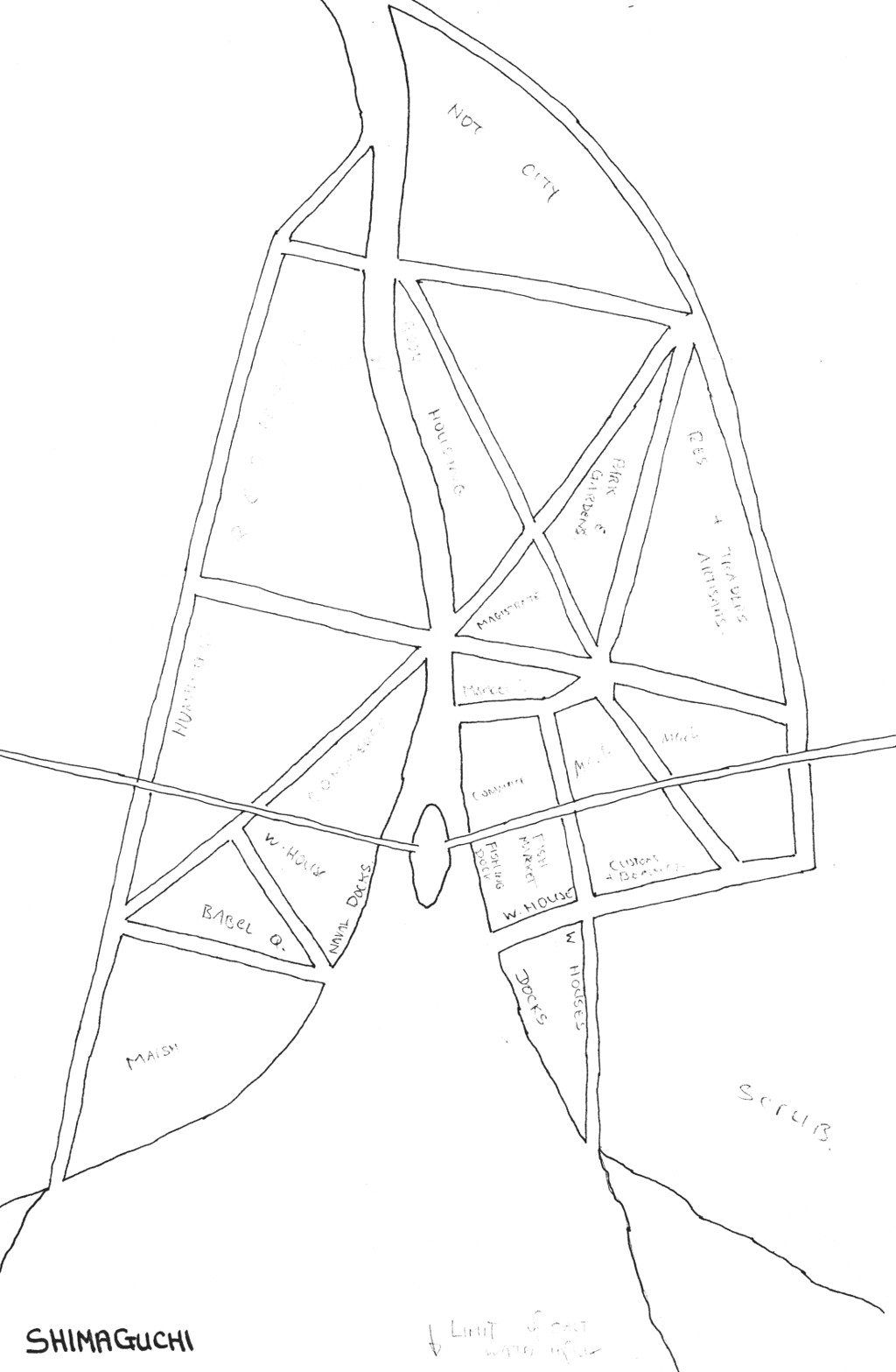
Shimaguchi is one of the main ports in the Empire of the Inner Sea. The city grew from a small settlement on the banks of the river Nichiguchigawa. The island of Nichishima was, at one time, the lowest crossing point on the river.
When the Empire of the Inner Sea expanded to the Northwest Shimaguchi became a Kezriakor settlement. The original settlements were in what is now Furimachi on the eastern riverbank. In the usual Kezriakor style many canals were dug here. Later development turned to the western bank which is now Atarashiimachi. This area is much more regularly planned. The final development was to excavate the two canals at the north of the city which channel excess water from the Nichiguchigawa river to the sea by way of the outermost canals. The river could then be safely terraced. Now the river meanders slowly down to the island and many fine tree line its banks.
The Imperial Road crosses the river at the bridging point and runs through the town. It runs along the coast to the west and eventually to the border of the Empire. To the east the road runs to join another Imperial Road that runs north/south.
The network of canals serve two purposes: as an efficient transport network and as an important aspect of Kezriakor lifestyle. Canals typically have a deep central channel, while on either side is a just submerged terrace; never more than a meter in depth. Here Kezriakor sit to rest when tired and there are many “inns” on the canal banks supplying refreshments. Steps or a gentle incline lead up to dry land. The place where two or more canals join thus become very much like a square or plaza in human society.
There are two forms of money which are in widespread us in the Empire: Small circular metallic disks with a hole in the centre known as “shu” and very fine rectangular sheets of silk known as “Shimei”. The silk is woven from specially dyed threads and patterned into very beautiful designs. Since Shimei are a fabric sheets (sealed at the edges to prevent unravelling) and use permanent waterproof pigments they can be carried at all times, both on land and in the water.
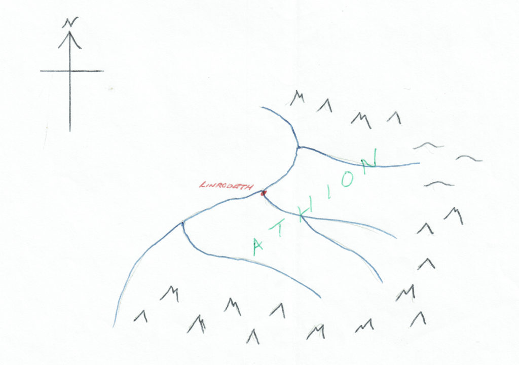
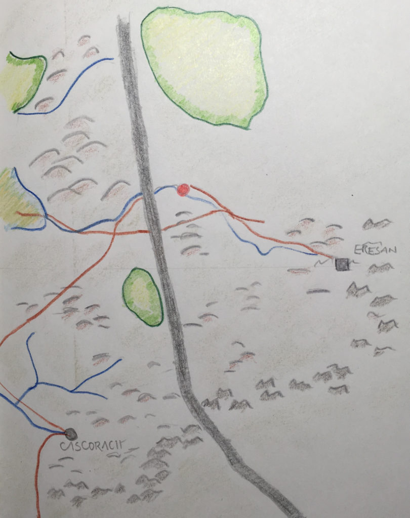
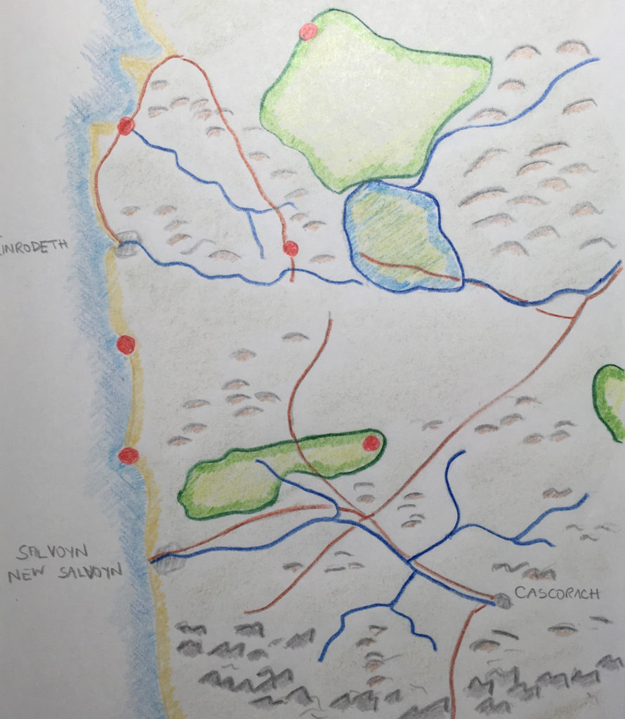
The country of Athion lies on the western edge of a great continent. The country nominally covers both halves of a great escarpment, roughly aligned north/south, that splits the country. In practise the lands above the escarpment have significant independence from the those below. The capital city is Linrodeth, but the city with the greatest population is Salvoyn to the south of Linrodeth.
Athion is a fertile country whose prosperity owes much to its agriculture as to the trading along the sea routes. The country was formed five generations ago, by right of conquest, out of three smaller kingdoms which can existed there previously.
There are as many religions in Athion as there is diversity of opinion. No officially approved religion exists, but some are large due to popular appeal (e.g., the earth goddess, the healer god), some powerful due to their strong organisation, others are rich by patronage and some are influential because they are so useful.
Despite the feudal government of the country, status within this society is very mobile. Neither the war nor the plague were particularly fussy about their victims, leaving in their wake many more posts than good people to fill them. This is particularly true in Linrodeth where a good craft and a comfortable profit have always been respected, and money speaks louder than an impoverished title. Although there are always the diehards….