Saizeriya

Image Metadata
- Mimetype
- image/jpeg
- File Size
- 1,096,357 bytes
- Image Size
- 1570x1104
Other Sizes: thumbnail(150x150) medium(300x211) medium_large(768x540) large(1024x720) 1536x1536(1536x1080) 2048x2048(1570x1104) - Alt Text
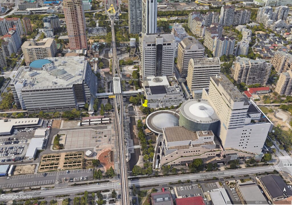
- A google earth image that shows a busy city view. There is an above ground metro station in the centre of the image with its metro line running vertically through the image. There are large complexes to the left and right of the metro station. The restaurant is on the southwestern corner of the right hand complex.
- Caption
- The Saizeriya restaurant identified by the backtrace of the network connection to the tank
- Description
- This image was captured from Google Earth Pro on September 3, 2024. It is actually of part of the real Rokkō island off of the City of Kobe in Osaka Bay
- Copyright Status
- This image was generated via Google Earth Pro. Please see the attribution in the image for the copyright and attribution details.