Favourite Walk
photos to enable me to attempt this blog post.
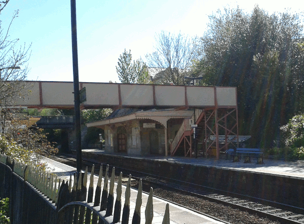 On this occasion, I did the Bradford-on-Avon to Bath direction, so starting. obviously, at Bradford-on-Avon. Since I use the train to get to Bradford, the walk starts there!
There's a direct train service from Romsey (FGW's Portsmouth to Cardiff service) and Bradford-on-Avon station was built by GWR (as evidenced by the supports for the benches on the platform - you can see the wooden templates for these at the STEAM museum in Swindon).
On leaving the station (over the footbridge) I head though the municipal car park to the river avon and under the railway bridge (signposted "Tithe Barn" - which I really ought to visit some day!)
I now head south through a park (the edge of the Barton Country Park) and up some steps to the Kennet and Avon Canal.
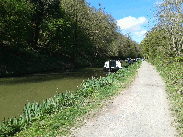 The Canal predates the railway, but was bought out by the GWR and allowed, over the course of a century, to fall into disrepair. Fortunately for me the canal was restored during the 1960s, 1970s and 1980s and the towpath forms part of the National cycle network route 24 (which goes from Bath to Eastleigh).
Being a canal (and this section is without any locks) this part of the walk is nice and flat. On reaching the tow path, I turn right and head west along the towpath.
There's usually plenty to see including canal boats (both moored and chugging along) and ducks and sometimes other wading birds (I've seen herons, swans and other similar birds). Along this stretch of the canal, there's also plenty of other walkers and cyclists to watch out for.
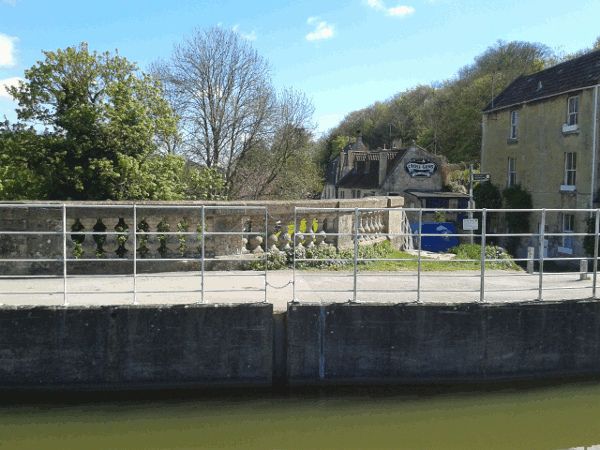 After about a mile or so the canal reaches the village of Avoncliff and its aqueduct (Note the photograph isn't one of my best - I need to try to take a better one, probably from the railway station). The towpath cross under the aqueduct at this point, if you don't change sides you'll end up at Avoncliff's railway station (trains about once a hour stop here, my train from Romsey does not stop at either Avoncliff or Freshford, the next station down the line about two and a bit miles further down the railway line).
The Cross Guns pub is a nice place to break the walk, though as it's close to the start of the walk, I normally just continue onwards. The beer garden is down the slope to the left (in the photograph) and has an excellent view of both the aqueduct and the river Avon.
The aqueduct crosses both the river Avon and the railway line and the route now turns west to follow the contour line along the northern edge of the river valley.
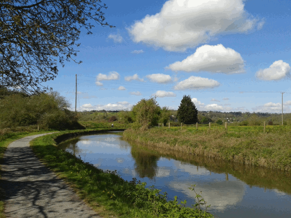 This next stretch of the walk is quieter (there are both fewer walkers and fewer cyclists, though I do continue to keep an ear for cyclists sneaking up behind me. The railway initially stays relatively close to the canal until the contour line for the canal gently curves off to the north.
There are some excellent views across the river valley, though you do have to peer through the trees to catch a glimpse.
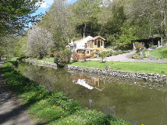
There are a few houses along this stretch of the canal - I would guess these would be quite expensive if they came on the market!
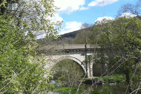 After about four miles or so the canal needs to recross the valley to find a decent contour to follow. It does this via the magnificent Dundas Aqueduct (though this also needs a better photograph!). The aqueduct and the adjoining basin (which also connects to the Somerset Coal Canal).
This aqueduct, like that at Avoncliff, also recrosses the railway line, but note there's no station here. I have walked from here to Freshford railway station that's about two miles to the south. Unfortunately to reach it does require a walk along a stretch of the B3108 which doesn't have a pavement, so some traffic dodging is required.
Here there's a decision to be made on the route to Bath. You can continue to follow the towpath (note that just past the aqueduct it crosses the Kennet and Avon Canal again). This takes you into Bath via Bathampton and the glorious Syndey Gardens and though a couple of short tunnels to the flight of locks that joins the canal to the River Avon close to Bath Spa station.
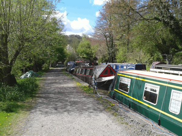 This time, however, it's the route via the Coal Canal that I'll take. This short section of restored canal is used as a mooring for lots of narrow boats and leads to the Angelfish Cafe which is a good point to break when I haven't brought sandwiches. (There's also boatyard here).
From here we head along footpaths that allow me to skip part of the National Cycle Route 244, but end up quickly rejoining that as it heads through the grounds of the Monkton Combe Private School to the village itself. From here I head through the church yard to again rejoin the cycle route until it reaches Tucking Mill. As a walker I can use the short cut that leads past Tucking Mill reservoir. The reservoir is used (according to the various notices) for angling for disabled anglers though it has always been quiet when I've visited.
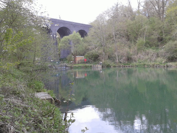 I now head up the slope to the top of the viaduct to rejoin the National Cycle Route 244 again. The viaduct forms part of the old Somerset and Dorset line that led from Bath (Green Park) to Templecombe via Evercreech Junction. For most of the rest of the walk, I (and the National Cycle Route) will follow this old converted railway line into Bath.
If I've brought sandwiches I'll break for lunch at the top of the viaduct - As I'm back on the cycle route there's some passing cycle traffic, but I'm still far enough out from Bath, that it's relatively quite.
This section of the S&D opened in the 1870s and was closed as part of the Beeching Cuts in 1966. The route reopened as a shared use (walking and cycling) path in 2013 (just in time for me to start using!)
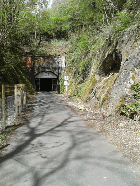 I now head north along the path (as the route up the slope to the viaduct is on the south side of the viaduct, this means I get to cross the viaduct, though fencing along the edges of the viaduct stop you from getting to the edge. Very shortly after the viaduct the path reaches the Combe Down tunnel.
This tunnel is about a mile long with bends near beginning and end. It takes me about 15-20 minutes to transverse. There is (dim) lighting throughout the tunnel, but it's definitely a strange experience. One of the oddities is realising that there's a suburb of Bath (Combe Down) above your head, yet it was countryside when you entered the tunnel (on leaving the tunnel it is a little more obvious as there's a junior school near the route here).
After Combe Down tunnel there a short stretch out in the open before we dive underground again via the Devonshire tunnel. This tunnel is much shorter (just over quarter of a mile) but twister so you still can't see from one end to the other.
I've yet to take a decent picture inside the tunnel (I need to avoid temptation and not attempt to include the end of the tunnel!).
Once though the two tunnels, the route continues along the old railway route as part of the "Linear Park" (Linear in this case used to imply thin as it's definitely not straight) leading you to Oldfield Park.
I normally leave the path here to head more directly into Bath (on this occasion I attempted to find the River Avon to head alongside the river back into Bath. However I failed to accurately reverse the route I have taken in the past and missed the riverside path (the bridge I used had no good connection to that path) so I ended up following relatively busy roads back into Bath.
As usual for the Bradford to Bath walks, I ended up missing the train back to Romsey by ten minutes (though in this particular case it wouldn't have mattered as that train ended up being cancelled anyway).